Dear participants of Zagori Mountain Running,
In the following link, you will find details concerning the route, such as elevation differences, weather forecast, terrain quality, kilometer distance, etc.:
As you will notice, there are slight variations in the total kilometers (and also in elevation differences) due to the method we used for measurement.
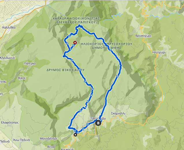
The official data for the route are as follows:
- Distance: 60 km
- Elevation Difference: 4000 m
Below, you will find the .gpx* file that you can “load” into devices that support it.
The route markings are dense, and it is extremely difficult for someone to get off track. Markings are even present in places where they may not be necessary, simply as "confirmation" for the participants.
In case you do not see any event markings for more than 80-100 meters (red color), please return to the last point where you saw markings and proceed in the obvious direction.
We are looking forward to seeing you at Tsepelovo,
Good luck and have fun!